Storm Tracker: Winter Storm Possible This Weekend
Based on the latest forecast model data, a winter storm continues to show potential impacts for the Crane area beginning late Friday and continuing through the weekend. While details are still being refined, multiple models indicate accumulating snow across southwest Missouri.
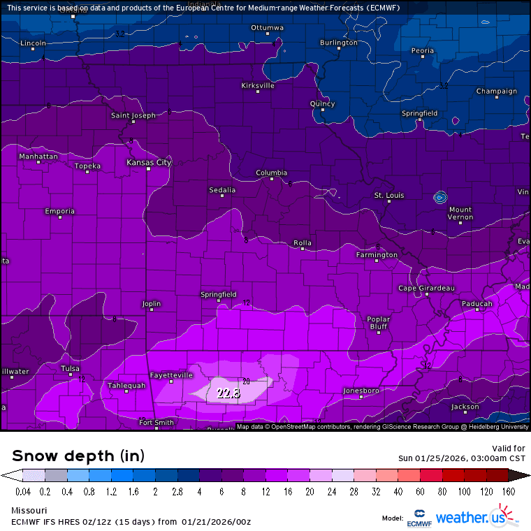
The European (ECMWF) model currently shows snow developing in the area Friday afternoon, with heavier snowfall moving in Friday night. Under this scenario, snow becomes more widespread overnight, with accumulations increasing into Saturday. The ECMWF indicates the potential for several inches of snow by Saturday morning, with continued accumulation through the day and snow tapering off early Sunday.
The American (GFS) model presents a slower and lighter scenario. It brings snow into the area later Friday night, with more modest accumulations through Saturday. Under this model, snowfall continues into Sunday before exiting the region early Sunday afternoon.
At this point, differences between the models are focused on snowfall intensity and duration rather than whether snow occurs. Current guidance supports the potential for several inches of snow in the Crane area, though final totals will depend on how the storm evolves over the next few foreceast cycles.
For clarity, the ECMWF is showing a total snow depth of ~12 inches, whereas the GFS is showing around ~6 inches - both of these could (and probably will) change as the weekend gets closer. Once we get to late Thursday/early-Friday, the HRRR model will give a much more clear picture of what we should expect for timing.
Residents should be prepared for the possibility of slick roads, particularly overnight and during early morning hours this weekend. Travel impacts will become clearer as confidence increases in timingi and snowfall amounts.
This Storm Tracker will remain active and updated as new forecast data becomes available.
- Weather.us Model Charts (opens in new tab)